![](https://cdn.myportfolio.com/a90f575ad6a64f7770c566f11e02ac55/5a8f5d9f-e6b1-4bb9-b077-45e873125093_rw_1200.png?h=cdf4a57895360a4eb4a34954cff7fa7d)
![](https://cdn.myportfolio.com/a90f575ad6a64f7770c566f11e02ac55/a5301d88-8f9f-436b-823d-06c5dd0e40df_rw_1200.jpg?h=724c67e40a5404936e9e4ce7a79d5a4c)
![](https://cdn.myportfolio.com/a90f575ad6a64f7770c566f11e02ac55/bf539f2e-bd58-427c-9ecf-67ac28ea701f_rw_1920.jpg?h=e76b4096ab686182656535f0f5b6a1e6)
![](https://cdn.myportfolio.com/a90f575ad6a64f7770c566f11e02ac55/8748f2d4-0cd9-4cfc-b2c6-c8c45e53e705_rw_1920.jpg?h=4ac90b3386ff9904c7a4076834a96d2d)
![](https://cdn.myportfolio.com/a90f575ad6a64f7770c566f11e02ac55/43370a4b-a3b4-4d7f-8775-ec3a100c3c35_rw_1920.jpg?h=68e1329acd5a06a51a0fe90d9ce61bf2)
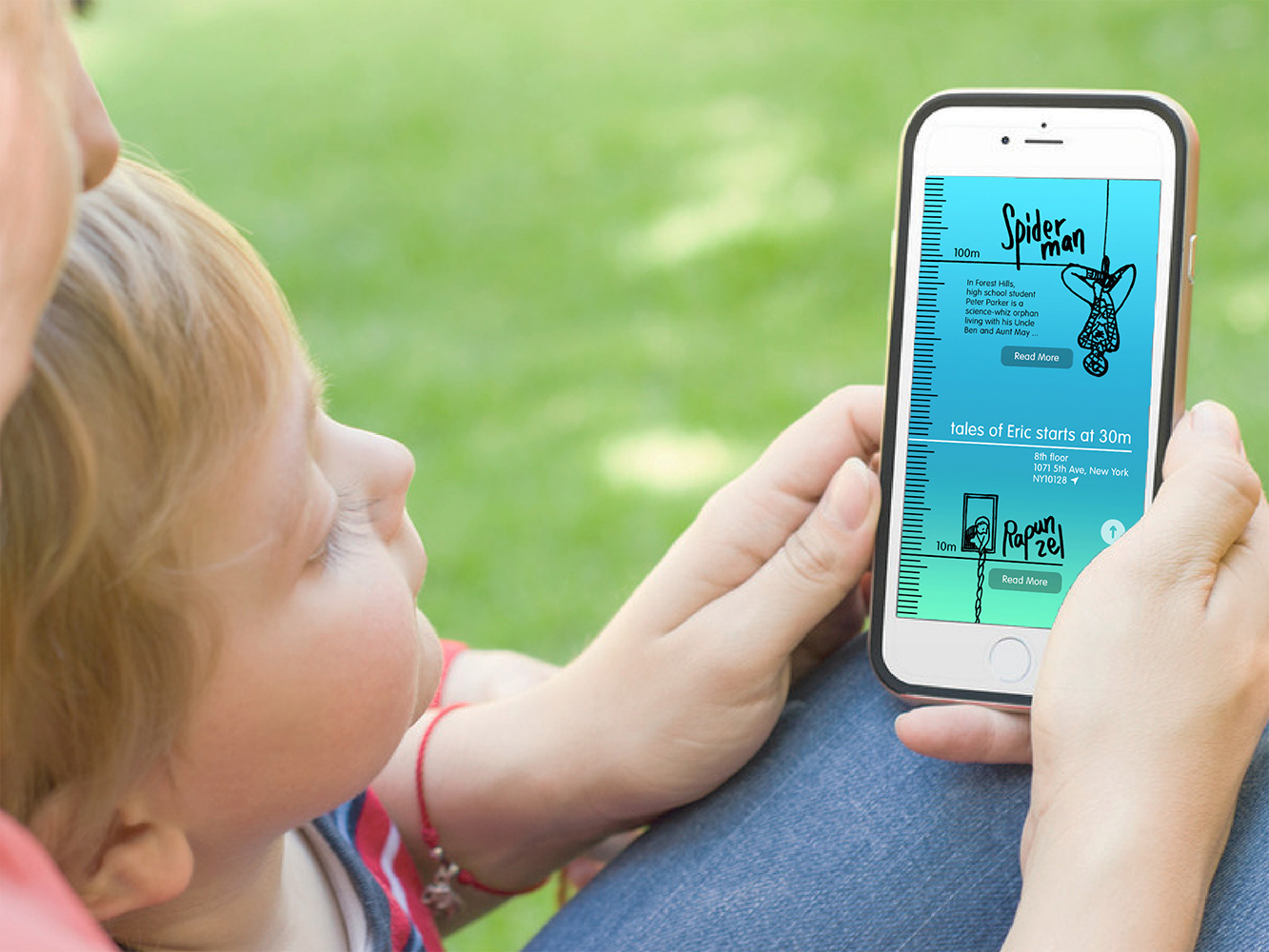
There's also an option of mobile app related with the picture book. Users get into the story world with “where they are now” information, by adding geo-tags/elevations.
![](https://cdn.myportfolio.com/a90f575ad6a64f7770c566f11e02ac55/800100f9-c43e-4f77-8551-291e4290a00a_rw_1920.jpg?h=a2f6a4a047997b7c2d1f7c814aa7d9ec)
![](https://cdn.myportfolio.com/a90f575ad6a64f7770c566f11e02ac55/c14df108-dfb0-491b-a44e-c826cc4e4714_rw_600.png?h=7ad86fa7dce864460c9e11367db631cf)
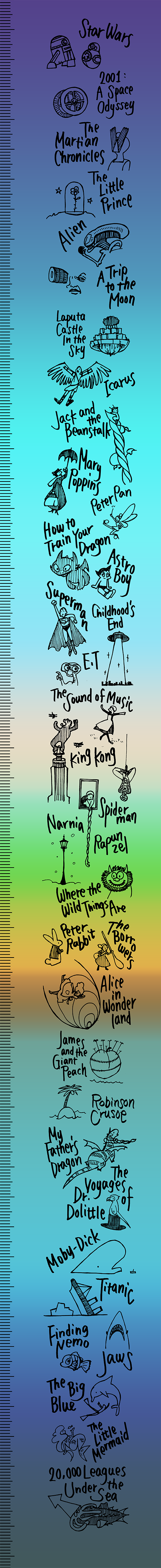
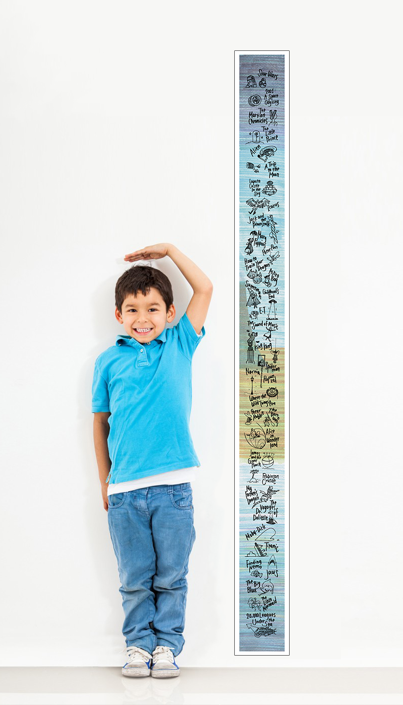
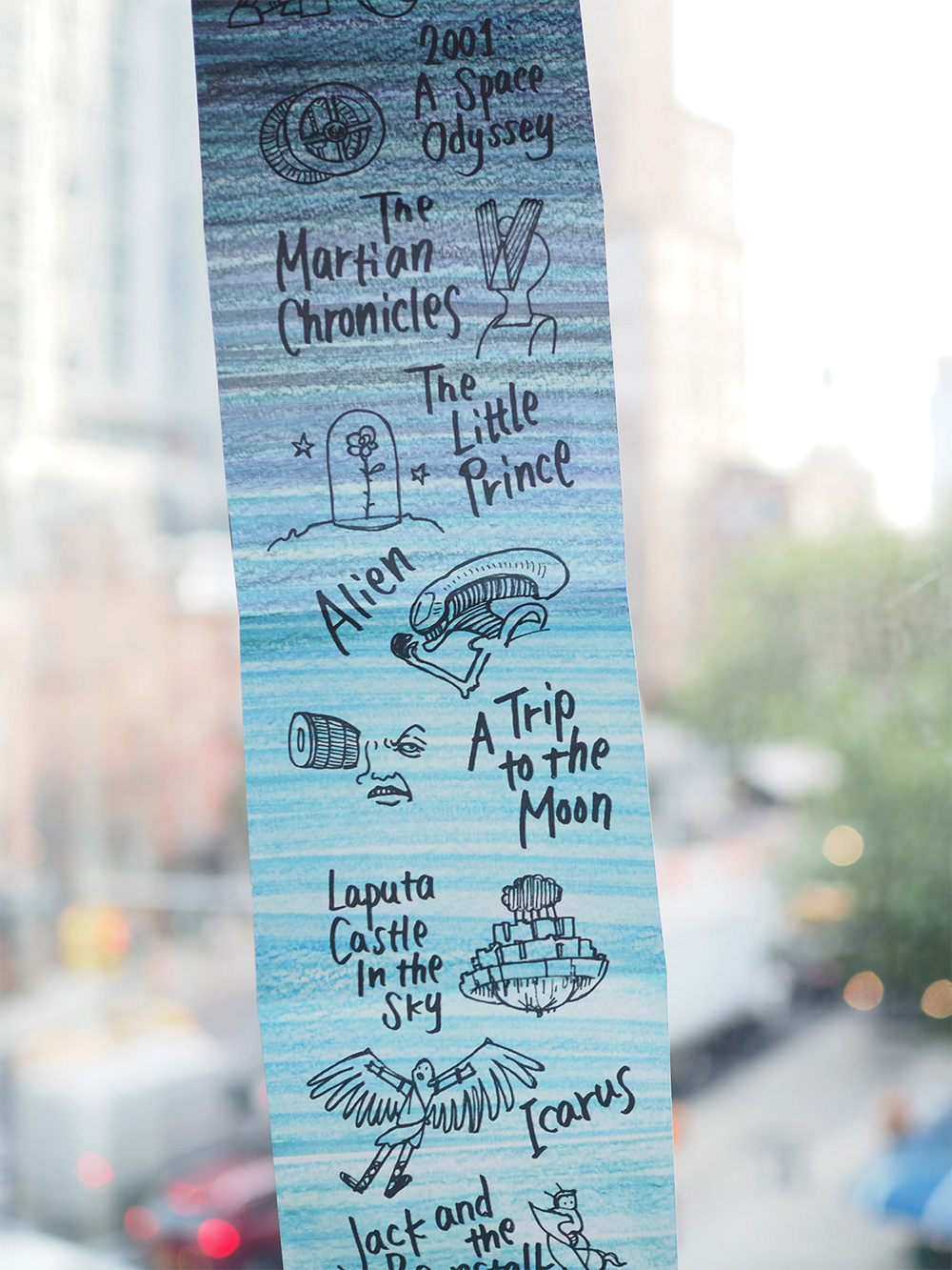
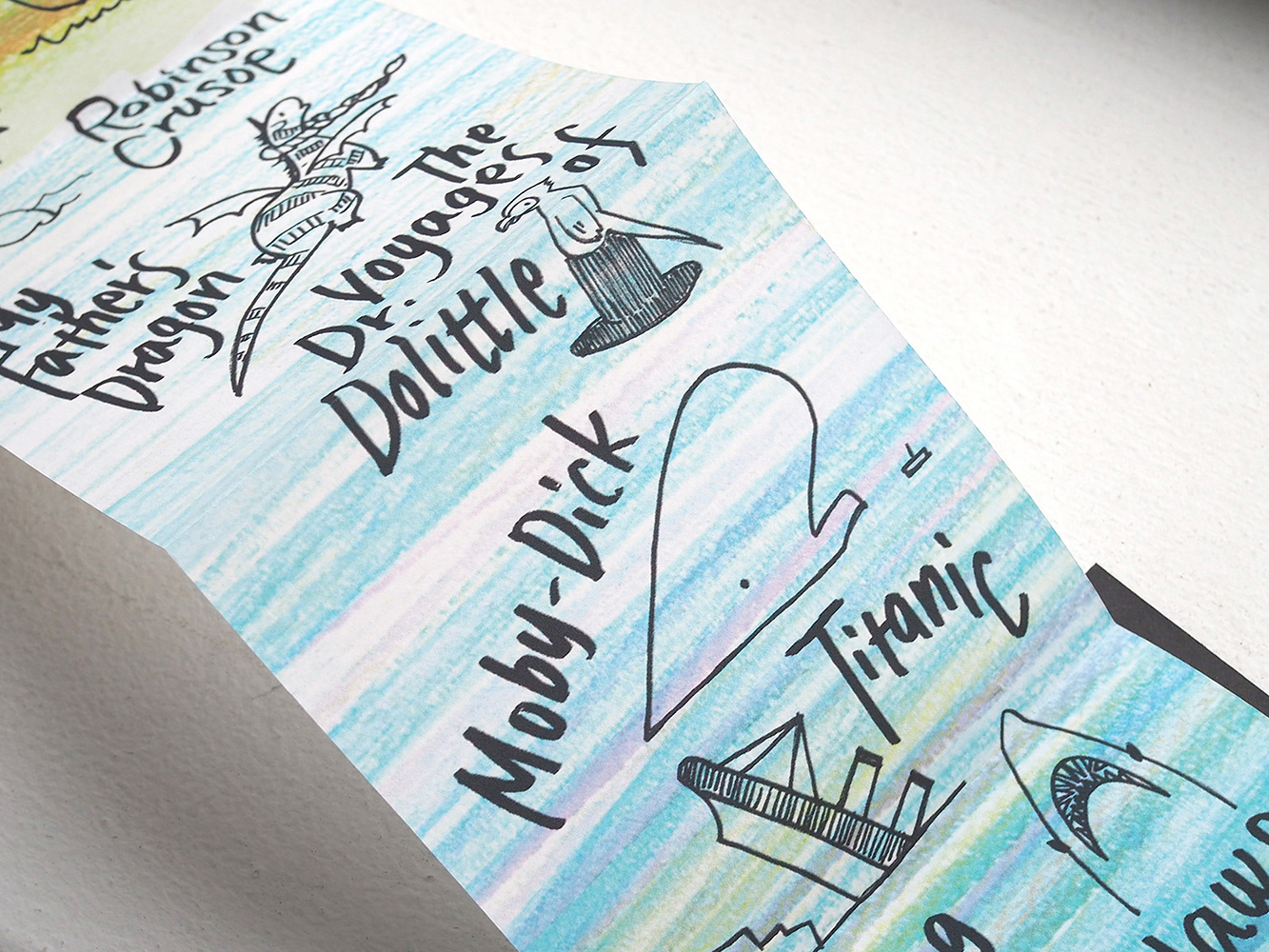
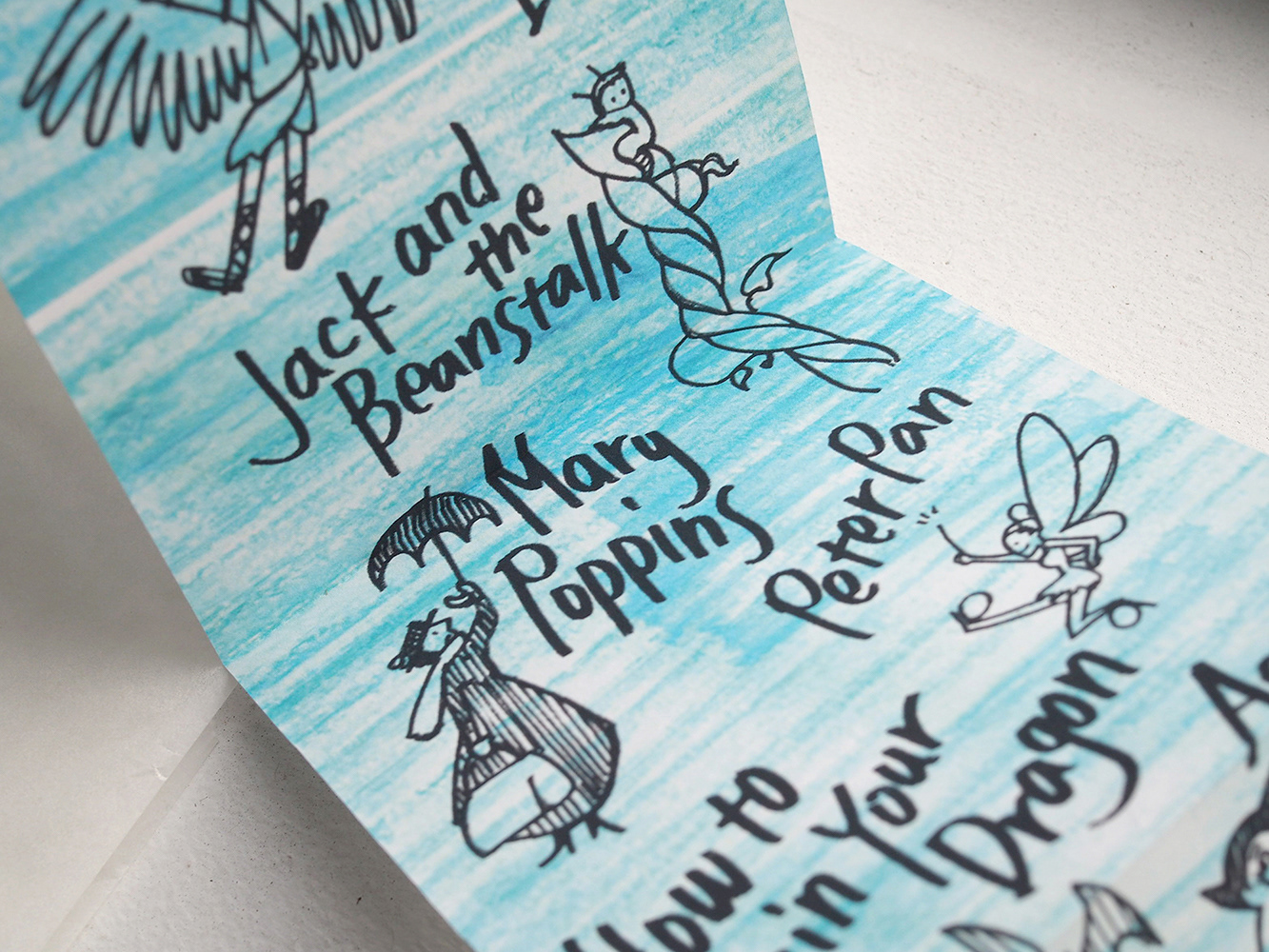
“Tales of Altitude” is a visual map which tells us how high and low the famous stories are located. It might be an unique guide map for children’s reading. It also might be a treasure map for adults, to travel memorable places once more. This handmade accordion folding picture book was exhibited and sold at MoCCA festival 2016, hosted by Society of Illustrators, 4/2-3/2016.